


Drone Surveys: Small UAV Aerial Imaging and inspections
WHAT ARE DRONE SURVEYS?
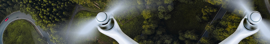
Drones or small Unmanned Aerial Vehicles (UAVs) are remotely operated rotary or fixed wing aircraft that can photograph or video data from an aerial perspective.
HOW CAN DRONE SURVEYS HELP ME?
Drone surveys can be utilised in a variety of ways that can be used as a standalone tool, or used in combination with specific surveys. Below is a description of several uses for drones:
INSPECTING STRUCTURES & HABITATS
Sometimes it can be dangerous, or in impractical to access all, or part of an area. This could be due to health and safety concerns, obstacles or access issues that may prevent these areas from fully adequately assessed. Buildings, bridges and trees are all used by bats. Using a drone to fly around the roof a multi-pitch roof building can help identify potential bat access points that would not be seen from the ground. Similarly, a drone can be used to record river banks, woodland canopies or dangerous structures. This tool can save time and money on other costly methods for obtaining the necessary data.
AERIAL IMAGERY
Obtaining up-to-date aerial images can be essential when assessing or monitoring habitats and sites. This can provide an invaluable scoping tool for large areas or otherwise inaccessible areas by foot (e.g. marshes, rivers etc.). Photographs can be taken in high resolution and stitched together to create a large overall site image.
MARKETING
Aerial photographs and videos can really showcase a site, create stunning montages of a model development or habitat creation over time. Videos can be shot in stunning 4k definition with high resolution photographs and can be used for posters, websites, video advertising and much more to promote your projects or business.
QUALIFIED, EXPERIENCED, INSURED
The Civil Aviation Authority (CAA) require a level of training and competence to use drones in a commercial sense. Aether Ecology staff have been trained by a recognised Nationally Qualified Entity (NQE) and certified by the CAA with a Permit for Commercial Operations (PfCO). We are also fully insured to operate drones within the limitations of their use.
DRONE LIMITATIONS
Like all good tools, drones do have their limitations and their usage can often be situational and weather dependent. Because the use of drones is regulated by the CAA, and as such they can share airspace with other aircraft. Certain airspace may be restricted (e.g. airports, military sites etc.) within a certain radius. It is also not possible to fly within certain distances or structures, people, property or busy areas (e.g. cities, large crowds etc.) without specific permission. Drones will not be able to fly in rain or high wind.
Depending on the above factors, the use of drones should be applied appropriately in a safe and legal manner.